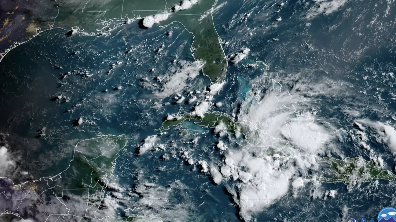
A disorganised weather system is currently moving across Cuba, bringing strong winds, heavy rainfall, and ocean surges to the Florida Keys and the state’s Gulf Coast. Forecasters predict that this system will develop into a tropical storm over the weekend after it enters the Gulf of Mexico.
The National Hurricane Center (NHC) expects the storm to bring up to 12 inches of rain and winds reaching 73 mph as it moves northward, according to a report from Reuters.Once the storm moves inland, it is anticipated to reemerge along the Atlantic Seaboard and slowly move along the coasts of Georgia and the Carolinas in the early part of next week.
In preparation for the expected landfall, Florida governor Ron DeSantis has already placed most of the state’s cities and counties under emergency orders. NHC deputy director Jamie Rome said, “It’s over Cuba right now. We are anticipating it to turn into a tropical storm over the weekend. Right now it’s a broad, sloppy system but we expect it to become more organized when it’s back over Gulf waters.”
If the system intensifies into a tropical storm, with winds between 39 mph and 73 mph, it will be named Debby.
US forecasters predict an active 2024 Atlantic hurricane season, which began on June 1, with a total of 25 named storms, including four to seven major hurricanes.
This is more than the record-breaking 2005 season that produced hurricanes Katrina and Rita. So far this year, only one hurricane, Beryl, has formed in the Atlantic, ravaging the Caribbean and Mexico’s Yucatan Peninsula before moving up the Gulf Coast of Texas as a Category 1 storm with winds up to 95 mph.
Rome emphasised that regardless of whether the current system strengthens into a tropical storm, it will bring significant rainfall to parts of Florida, saying, “People often use wind speed as a proxy for how dangerous a system is. But this is a classic case to not do that. The rain rate, it comes down so quickly, makes it dangerous.” He added that it is too early to predict exactly when or where the storm might make landfall this weekend.
Authorities have announced tropical storm watches and warnings for the Gulf Coast and the Florida Keys as a precautionary measure. Teri Johnston, the mayor of Key West, expressed confidence in her community’s preparedness for the approaching storm. “Everyone’s on it, everyone knows what to do. Load up on 3-to-7 days of supplies and water, batteries, and remove all potential projectiles from the yard. We’re ready,” she said, emphasising the island’s readiness to face the challenge.
Forecasts indicate that the storm’s trajectory is likely to resemble that of Hurricane Ian, which devastated Florida in 2022. The catastrophic hurricane claimed the lives of at least 103 individuals in the state and left behind a trail of destruction, resulting in billions of dollars in damage as it traversed the Gulf Coast region. As the current storm approaches, residents and authorities remain vigilant, taking necessary precautions to minimize potential risks and ensure public safety.
Source : Times of India


